

Bug fixes and usability improvements
- Usability: When exporting to P1-90 format, latitude and longitude coordinates can be exported either in WGS84 or in the SurvOPT project’s geographic CRS.
- Usability: Option to create objects from bathymetry added to Edit > Objects submenu.
- Usability: New options available to display and export the calculated full fold polygon, when using the Fold feature. The minimum polygon size, in terms of number of bins, is adjustable in the Binning & Fold Configuration dialog > Fold Display tab.
- Usability: Decimation is now available when exporting receiver positions to P1-90 format.
- Usability: Length and area values in SurvOPT tables are now displayed to more decimal places, when dealing with very small lengths/areas.
- Usability: Preplot statistics in the New Scenario Wizard and Scenario Statistics display are now displayed to more decimal places, when dealing with very small areas.
- Usability: It is now possibile to zoom in further, when dealing with small survey areas.
- Fixed: Crash when attempting to create fold if survey vessel has no source and/or no streamers.
- Fixed: Crash when attempting to import preplot line that contains segments shorter than one shot point interval.
- Fixed: Intermittent crashes when attempting to add, view or edit an environment constraint.
- Fixed: Bathymetry import can be blocked by an error, even after the error has been corrected.
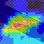
- Fixed: Very deep bathymetry points are sometimes assigned the wrong colour in the map display.