

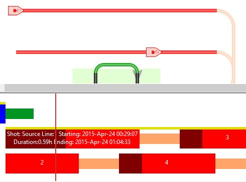
- Enforce a minimum separation between source vessels
- Optimize a survey within user-defined tiles
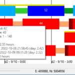
- New Alerts display panel
- Smarter interpretation of SPS files
- Bug fixes and usability improvements
Enforce a minimum separation between source vessels
A minimum distance can now be enforced between source vessels when shooting.
All turn patterns now include a Min Radial Vessel Separation property. When the distance between two source vessels (or multirole vessels when operating in their source capacity) is shorter than the min radial separation, one vessel will delay its task until the other vessel is out of range.
Delays are marked on the timeline in dark red.
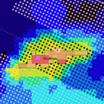
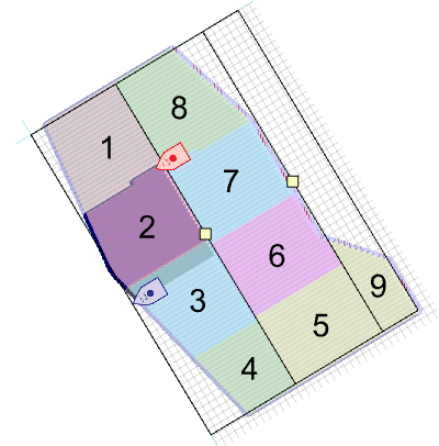
Optimize a survey within user-defined tiles
The Optimize Patches survey configuration can now be used in conjunction with Tiles.
Optimize divides a survey area into patches of optimal size and shape, aiming to minimise overall survey duration.
Tiling (also known as using “zippers” or “panels”) divides a survey into subsections of a set line length.
When Optimize and Tiling are used together, patch length will be determined by the tile settings, and patch width will be optimized.
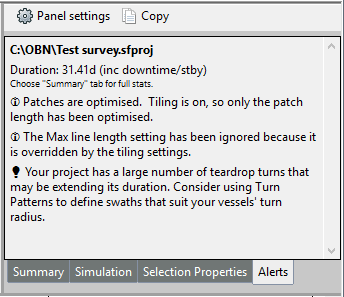
New Alerts display panel
This new panel displays warnings, error messages, key information and helpful hints for the current survey project.
The Alerts panel is located on the right side of the Seafloor Planner window, as a tab with the Summary, Simulation, adn Selection Properties panels.
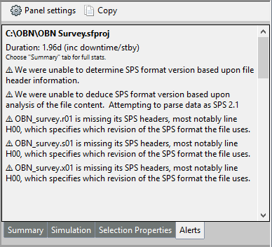
Smarter interpretation of SPS files
Note: Although SFP does its best to interpret all SPS files, we cannot fully guarantee intpretation of files where header information is missing/incorrect or data records are incorrectly formatted. We highly recommend ensuring that your SPS files match the SEG SPS file format specifications.
There are two similar, yet different, versions of the SPS file format published by SEG (version 0 and version 2.1). Differences include column numbers, left or right justification, and data type (e.g. floating point number vs. alphanumeric) in receiver and source point records and relation (x) records. According to the SPS format specification, mandatory file headers should specify key details including version information, however many of the SPS samples that we have seen fail to include complete and correct headers.
Consequently Seafloor Planner now takes a smarter approach when reading SPS files:
- If header information is missing or incomplete, SFP attempts to diagnose the SPS version through analysis of the data records.
- If data record analysis is inconclusive (for instance, in a file that includes minimal details the data may match either format, or in a file where line names are incorrectly justified it may match neither format), SFP first attempts to parse the data as version 0, and if that fails, as version 2.1.
- If non-critical errors are encountered, SFP will still build the survey if possible, and will display information about the errors on the new Alerts display panel.
Check the SPS file format specifications on the SEG website…
Bug fixes and usability improvements
- Usability: User interface terminology changes to avoid confusion regarding source lines vs. source sail lines.
- Usability: Downtime display selection saved in project file.
- Usability: More flexible parsing of receiver area polygon text files.
- Fixed: Vessels allocated batches of too many lines in Racetrack, One For Each Vessel turn pattern.
- Fixed: Outer lines not generated in source line patterns.
- Fixed: Crash if survey generation is attempted without any vessels in the project.
- Fixed: Measurement tool figures are hard to read when a vessel is in view.
- Fixed: Deleted vessels are sometimes included in a saved project. (Note: As this was due to an error in saving the project, the fix only applies to projects that are saved in version 2.2 and above.)