

- Important note on release 2.1: Source line generation changes for dual-source shooting
- Multirole vessels
- New/extended coordinate reference system capability
- Background images
- Set max line length for patch optimization
- Turn pattern optimization
- Bug fixes and usability improvements
Important note: Source line generation changes for dual-source shooting
Seafloor Planner’s treatment of source lines when Number of Sources > 1 haschanged in version 2.1. SFP now builds sail lines and populates each sail line with shot points, whereas previously SFP built source lines and grouped then into sail lines. For example, previously a 100-line survey with 2 sources would have resulted in 100 source lines and 50 sail lines. Now, a 100-line survey with 2 sources will result in 100 sail lines and 200 source lines.
If using an older project file in version 2.1, please check and adjust source line settings accordingly.
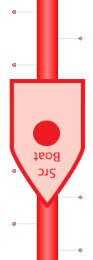
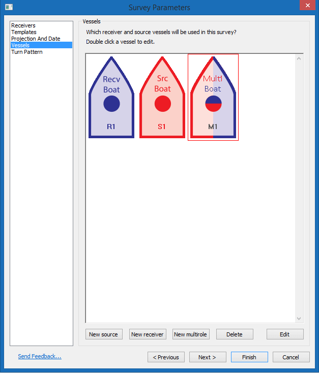
Multirole vessels
This new type of vessel is capable of both laying/collecting receivers and shooting.
Add or configure a multirole vessel on the Vessels tab.
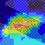
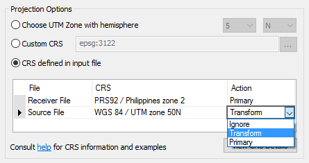
New/extended coordinate reference system capability
Seafloor Planner projects can now use a wide range of coordinate reference systems (CRS). The survey CRS is set on the Projection and Date tab.
Set the CRS by selecting a WGS 84 / UTM zone, searching for a CRS by name or code, entering an EPSG code, Proj.4 string or WKT string, or by selecting a CRS found in an input file (source, receiver or relation file).
If an input file uses a different CRS to that of the survey project, coordinates can be transformed during import.
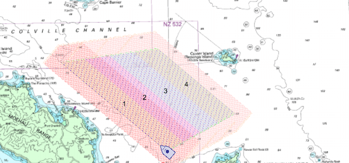
Background images
Background images are now available. An image can be loaded from a file (including georeferenced files), or downloaded from a web map service, Google Maps, or Bing Maps.
Access the Image dialog by right-clicking on the map and selecting ‘Configure Background’.
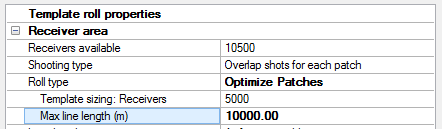
Set max line length for patch optimization
Patch optimization now has a max line length setting: the optimizer will restrict receiver line length within each patch to this length or shorter.
This setting may be particularly useful when receiver line length is limited by cable length.
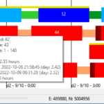
Turn pattern optimization
The new ‘Divide evenly by time’ turn pattern option improves survey efficiency by optimizing vessel line allocation. For example, in a survey where there are two source vessels that shoot at different speeds, the faster vessel is likely to be allocated more lines. Similarly, if there is a multirole vessel that is busy on receiver collection, the optimizer is likely to be allocate this vessel fewer shooting tasks.
Bug fixes and usability improvements
- Usability: Adding a vertex to a polygonal obstruction in the map is now easier.
- Usability: Summary / Simulation panel settings icon is now more clearly labelled.
- Usbaility: Selection details panel now displays vessel initials, when a vessel is selected.
- Usability: Vessels tab and Vessel dialog layout improved.
- Usability: Map display options now saved in project file.
- Fixed: Obstruction dialog doesn’t scroll far enough to access seafloor settings, in certain setting combinations.
- Fixed: Non-Latin characters not supported in source line file names.
- Fixed: Selected patch number in Selection details panel does not match displayed patch number in map.