

-

Seafloor Planner 2.8.0: What’s New?
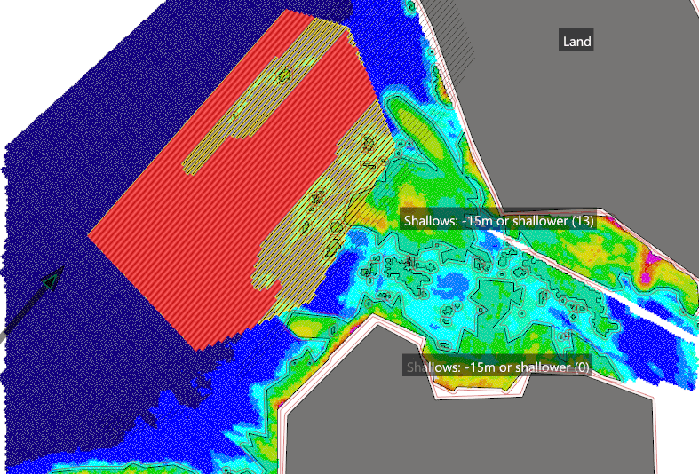
Seafloor Planner 2.8.0 includes a range of exciting new features, including multiple receiver vessels, a more comprehensive turn pattern optimiser, new lay and collect efficiency options, and new displays for battery life and receiver inventory shortfall.
-

SurvOPT 3.11.0: What’s New?
- Import preplot lines from P1/11 format
- Adjust the amount of line simplification when importing 4D lines
-
-
-
-
Seafloor Planner 2.6: What’s New?
- Support for coordinate reference systems using feet
- Periodic reports: Export statistics at selected intervals over the survey plan
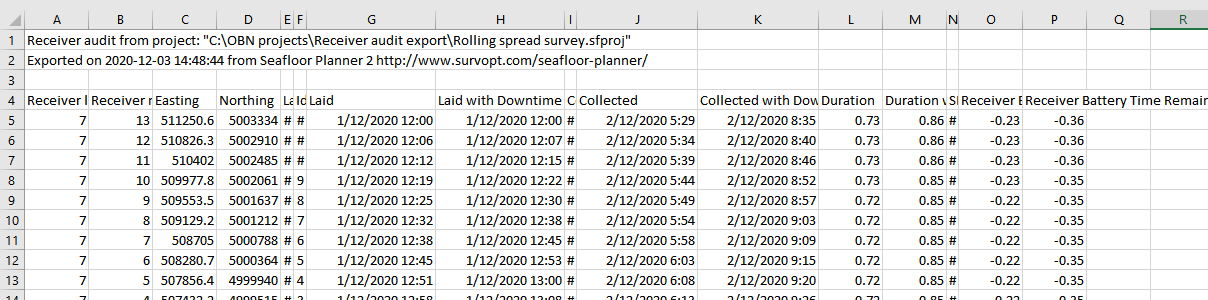
- Optionally handle receivers in full lines, in rolling spread surveys
- Bug fixes and usability improvements
-
-
Seafloor Planner 2.5: What’s New?
- Receiver and source area polygons can now be loaded from shapefiles
- New receiver points CSV export available
- Bug fixes and usability improvements
-
SurvOPT 3.9.0: What’s New?
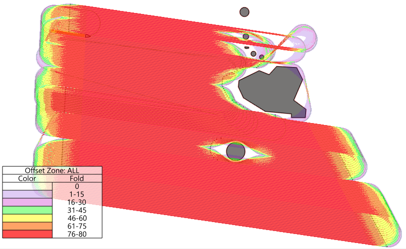
- Many new fold display options
- Include fold from shooting on turns, and from acquired sequences
- New fold statistics, and configurable fold statistics region
- Optional fold audit file
- Obstructed Length added to Scenario Statistics
- Bug fixes and usability improvements
-
